Data Acquisition

How we work
Compiling the datasets
RTK (REAL-TIME KINEMATIC)
RTK provides real-time corrections to the positioning data captured by a GPS receiver. It works by establishing a communication link between a base station at a known position and a rover (1) (e.g. a drone or GPS receiver in the field). The base station transmits corrections to the rover (2), allowing it to correct its positional data in real-time, achieving centimeter level accuracy during flight or operation (3). This method is highly beneficial for time-sensitive applications requiring immediate data delivery (4).
PPK (POST-PROCESSED KINEMATIC)
PPK involves post-flight processing of GPS data by comparing the collected data with that of a known reference station. Unlike RTK, PPK does not require real-time communication between the base and rover, providing greater flexibility in areas prone to signal interruptions. PPK typically offers higher accuracy, as corrections are applied after data collection, minimizing the impact of any signal loss during operations.
GCPS (GROUND CONTROL POINTS)
GCPs are physical markers placed at known coordinates on the ground, providing additional reference points to improve accuracy further. By integrating GCPs into an RTK or PPK workflow, the absolute positioning of the data can be confirmed and enhanced, compensating for any potential GPS inaccuracies.
“The combination of RTK, PPK, and GCPs provides a robust solution for achieving the highest possible accuracy in drone-based data acquisition. This hybrid approach ensures reliable, centimeter-level precision, making it ideal for projects with stringent accuracy requirements, such as infrastructure development, and environmental monitoring.”
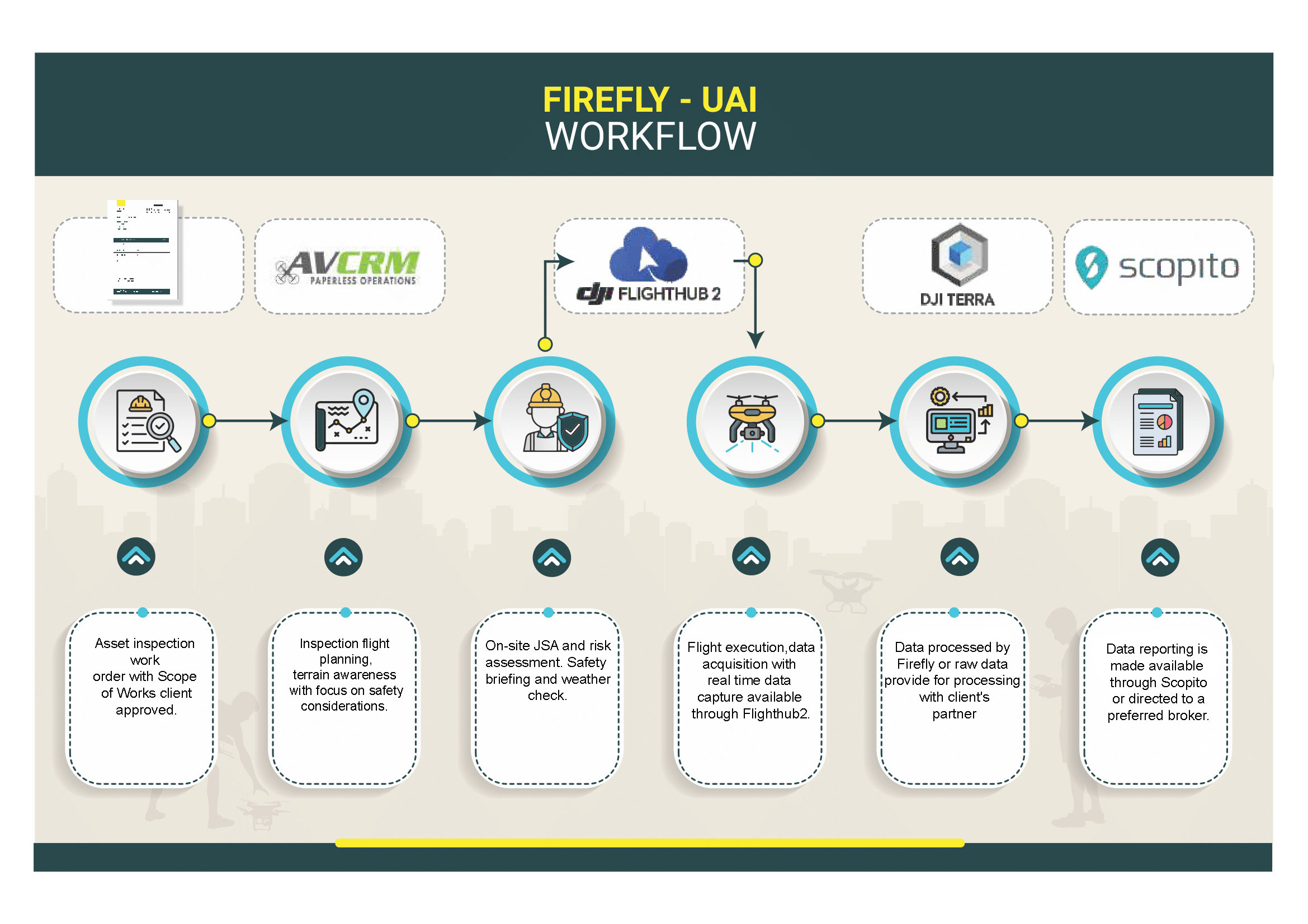
This workflow diagram shows the step-by-step process of data collection and management during a drone operation. From initial work orders and flight planning to risk assessments and data acquisition, every stage is carefully coordinated. The data collected is processed and reported efficiently, ensuring comprehensive insights for clients. This organized flow enables smoother operations, maximizing accuracy and safety throughout each drone mission.
