Drone‑collected datasets for rapid fugitive gas detection and insights driving ROI
High-resolution aerial data and multi-gas detection for compliance, safety and ROI improvement
- Protect your assets, people, and the environment while saving time and money.
- Improve worker safety by reducing exposure to hazardous areas.
- Increase ROI by detecting and preventing methane slip.

AERIAL INSPECTIONS FOR GAS DETECTION AND STOCKPILE ASSESSMENT
Providing 3D mapping, stockpile assessments, and emission-detection for air quality compliance
Aerial data acquisition provides rapid detection of fugitive gases for emission reporting compliance, stockpile volume assessments and construction progress reporting. We will provide the raw data for in-house processing or forward the data for processing and evaluation to the platform of your choice. Sniffer4D Mini2 consists of compact, powerful multi-gas detection hardware and user-friendly software.
The system, mounted on a compatible DJI drone, can measure and visualise real-time gas concentration distributions. By providing timely, actionable information, Sniffer4D Mini2 provides the oil & gas industry, environmental protection agencies, and researchers improved efficiency, mitigated risks, and reduced costs.
WATCH: High-resolution drone data tailored for construction, mining and emissions monitoring—supporting accurate stockpile measurements, site progression analysis and air quality checks.
Remote Monitoring and Data Insights
UNCREWED AERIAL DATA ACQUISITION FOR CONSTRUCTION
Firefly-UAI provides fast, reliable, high-quality data acquisition services tailored to the construction and infrastructure monitoring sectors. Our solutions meet industry demands, delivering localised, high-resolution data for processing.
From construction sites to renewable energy projects, we conduct remotely piloted monitoring assignments, offering raw data for in-house processing or complete processing on your chosen platform. Based in Sydney, we understand the unique challenges of project development and long-term monitoring.
High-resolution aerial imagery enables precise stockpile volume assessments and site inspections—delivering valuable insights for construction material management.
OTHER SERVICES

Structural Lifecycle Assessments
We provide photogrammetry data to the real estate and property management sectors. This detailed, high-resolution imaging of buildings, roofs, facades, and structures allows clients to quickly identify any cracks, water damage, or structural integrity concerns.

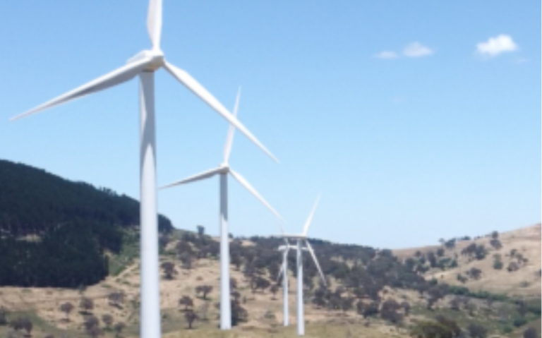
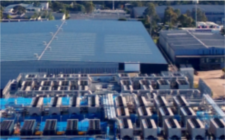
Renewable Energy Inspections
Biogas facilities and landfill sites are often expansive, making traditional inspections time-consuming. Drones can cover large areas quickly, making them ideal for tasks like site monitoring of waste decomposition for the assessment of environmental impact.

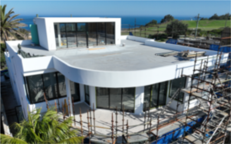
Construction Progress Reporting
Across construction, we leverage advanced drone technology to deliver precise data for progress inspections, as well as detailed site measurements for the Architecture, Engineering, and Construction (AEC) sectors throughout the broader area of New South Wales.

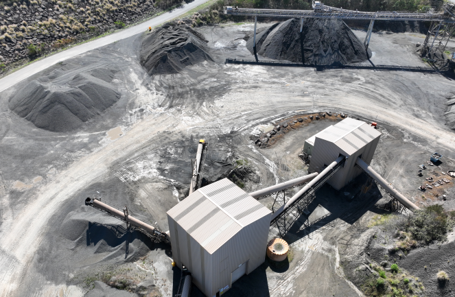
Stockpile inventory Intelligence
Accurate assessments of material stockpiles on construction and mining sites, allows for efficient inventory tracking and improved resource planning for projects. Aerial data captures details from above, offering a fast and cost-effective alternative to manual inspections.
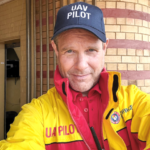
People Are Important.
The members of our team and the customers that we provide services to. Dignity, reward, and a safe working environment are important to us.
Sustainability In Action.
Rooted in renewable energy and low-carbon economy relationships, our commitment to best practices and environmental stewardship defines us.
Trust And Integrity.
Enduring relationships are built on trust and integrity. Through consistent delivery and transparent communication, we foster lasting partnerships based on mutual respect.
Driven by People, Purpose, and Partnership
MEET THE TEAM
At Firefly UAI, our success is driven by a dedicated team who are passionate about innovation and excellence in drone services.
Each member brings a unique set of skills and expertise to the team.
Matthew Hayden

CHIEF REMOTE PILOT
Matthew is our main pilot, responsible for drone collection, which ensures every data capture process is conducted with the highest standards of accuracy and safety, always prioritising value for clients. His background in technical leadership, quality assurance, and engineering top-quality drone services.
Gavin Craig

REMOTE PILOT & TECHNICAL ADVISOR
Gavin, our pilot and technical advisor, ensures seamless operations by using his expertise in data accuracy and systems performance. His strong knowledge of emerging technologies and industry standards drives innovation, making him a vital contributor to our success.
Pete Chrisensen

MEDIA & POST-PRODUCTION
Pete brings a lifelong passion for music and sound engineering, backed by over 30 years of experience in broadcast video and 20 years in 3D and CGI. As a versatile expert in all things digital, he excels at tackling technical challenges with creative solutions. Got a problem? Give him an hour—he’ll find the answer.
Celeste Vinassa

COMMUNICATIONS
Celeste is a seasoned marketing specialist with experience in strategic communications and adding brand value. She uses her expertise to enhance the Firefly-UAI brand and drive impactful messaging. Her innovative approach ensures that Firefly-UAI’s story resonates with its audience.
Archton

CLOUD SUPPORT
Archton supports Firefly-UAI with a cloud-first approach to solution architecture. With extensive experience in software development and cloud infrastructure provisioning, they provide valuable insights into I.T. governance and systems architecture, particularly in cloud services and containerisation.
BENEFITS OF REMOTE PHOTOGRAPHY AND AERIAL MAPPING
Increased Efficiency
Drone mapping is significantly faster than traditional ground-based methods, saving time and reducing costs.
Improved Safety
Drones reduce the need for workers to enter hazardous or hard-to-reach areas, enhancing safety and minimizing risk.
Digital Twins - Virtual & Physical
A digital twin is a virtual model of a physical object or landscape. With drones, businesses can quickly collect accurate data, monitor and optimise operations, and create real-time replicas of assets. This technology allows for comparing images over time, ensuring better quality control and collaboration with subcontractors.
Precise Terrain Modelling
It offers high-resolution aerial imagery and data used to create detailed terrain models, supporting consistent condition monitoring and streamlining critical maintenance.
AI and Photogrammetry Software
Drones collect high-resolution data that surpasses manual assessments. Advanced software platforms enable better planning, analysis, and decision-making. Drone mapping also allows for more frequent and accurate reporting, improving billing and overall project visibility.
Real-Time Decision Making
Drone mapping enables businesses to collect and analyse data in real-time, allowing for immediate decision-making and rapid response to changing project conditions. This leads to faster adjustments and more informed, agile project management.
CERTIFIED AND LICENSED FOR EXCELLENCE IN REMOTE DRONE OPRATIONS

We prioritise safety, professionalism and compliance, holding Civil Aviation Safety Authority (CASA) certifications, including a Remote Operator Certificate (ReOC) for commercial operations, and a Remote Pilot Licence (RePL) for licensed pilots.

We are proud members of the Australian Association for Uncrewed Systems (AAUS), connecting us to a network of industry leaders. These certifications and affiliations, combined with our commitment to regulatory compliance, ensure safe and efficient operations for all projects.